POINTS OF
INTEREST
Updated: 10.03.12
![]()
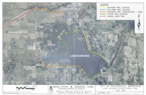
Lake Koronis Recreational Trail being completed ...
The trail, which connects the city of Paynesville with the trail around Lake Koronis, will be finished in 2012.
Phase I: Old Lake Road, completed in 2002 (yellow on above map).
Phase 2: Crestridge Rd./NW Koronis Rd./Breezewood Rd., completed in 2003 (blue on above map).
Phase 3: Pay. Area High School to Old Lake Road, completed in 2006 (blue on above map).
Phase 4: Pay. Area High School to Glacier Ridge Trail (pink on map), completed in 2008 (orange on above map).
Phase 5: Baywater to Sparkling Shores, completed in 2008 (orange on above map).
Phase 6: Sparkling Shores to Hwy. 55 Bridge, completed in 2010 (green on above map).
Phase 7: Hwy. 55 Bridge to Old Lake Road (Phase 1), completed in 2010 (green on above map).
Phase 8: Koronis Ministries Area and along Co. Rd 181 (connecting Phase 2 and Phase 3), is being completed in 2012 (green on above map).
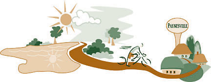
ENJOY THE RECREATIONAL TRAIL...
Leave the roadways, escape the shopping, turn off the television, shut down the video games, and escape the pace of everyday life...
COME OUTDOORS...
and explore the Lake Koronis Trail, Paynesville's safe, scenic, accessible, multi-purpose, recreational pathway. Now your adventures can start so close to home.
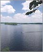
LAKE KORONIS TRAIL...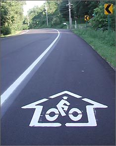 The trail provides a safe, non-motorized bicycle/pedestrian trail that connects the city of Paynesville with Lake Koronis and now makes a scenic loop around Lake Koronis.
Phase one opened along Old Lake Road in 2002 (shown at right). Another section of the trail was opened in 2003 along Crestridge, Breezewood and NW Koronis Road.
In 2006 the trail connecting Paynesville with the trail on Old Lake Road was opened.
In 2008, the trail in Paynesville was connected to the Glacial Ridge Trail which goes through Hawick, New London, Spicer to Willmar, and the trail from Breezewood Road to Baywater Rd. along the west end of the lake, and along the south shore to Sparkling Shores was finished.
Three more phases were completed in 2010 and 2011. Now in 2012 the trail is being completed around Lake Koronis with the construction of the trail along County Road 181, connecting the trail from Crestridge Road to the existing trail on the northern section of Co. Rd 181.
 The trail is beautiful all year long for bikers, hikers, in-line skaters, skiers, runners, leisure strollers, and walkers. Visitors can enjoy over 25 miles of trail. Access to the trail will be available by designated parking areas at three different points along the trail corridor.
You are sure to pick up a little education along the way because the trail extending around Lake Koronis will be an "ecological classroon" - wetlands, rivers, carp traps, bogs, birds, and plant life. Other sites include the public city beach, Indian mounds, Lake Koronis Regional Park and more. To see more pictures, go to points of interest.
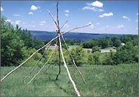
A tepee sits atop the Indian mounds overlooking Lake Koronis.
For more information: 320-243-3186 • jeffmarb@lakedalelink.net